
SURVEYING & MAPPING
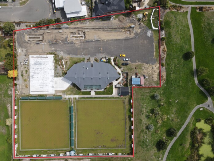
Drone technology has revolutionised the way surveying and mapping are carried out — offering high-accuracy, cost-effective, and time-efficient solutions for a wide range of industries.
Using GPS-guided flight paths, photogrammetry, and LiDAR sensors, drones can capture high-resolution aerial imagery and transform it into detailed maps, 3D models, and digital elevation data. This allows surveyors, engineers, and planners to make fast, informed decisions without the need for extensive fieldwork.
From construction sites and farmland to coastal zones and forest blocks, drone-based surveying delivers the precision and perspective required for today’s modern projects.
OUR SERVICE BENEFITS
Benefits include:
Uses of Drones in Surveying & Mapping
- Topographic Mapping: Capture accurate elevation and terrain data for engineering, construction, and land development.
- 3D Modelling: Create realistic 3D visualisations of landscapes, buildings, or infrastructure for planning and analysis.
- Volume Measurement: Calculate stockpile volumes for quarries, earthworks, or storage yards with high precision.
- Boundary and Property Surveys: Assist surveyors in collecting detailed imagery to support cadastral and boundary mapping.
- Infrastructure Planning: Support the design and maintenance of roads, utilities, and drainage networks through accurate site data.
- Environmental Surveys: Produce georeferenced maps for monitoring erosion, vegetation growth, or land-use changes.
- Coastal & Floodplain Mapping: Assess waterway movement, flood risk, and coastal erosion through repeatable, comparative mapping.
Advantages of Drone-Based Surveying
- Exceptional Accuracy: Utilises advanced GPS and photogrammetry to achieve centimetre-level precision.
- Rapid Data Collection: Covers large areas in a fraction of the time required by traditional surveying methods.
- Cost Savings: Reduces manual labour, equipment hire, and travel time for on-site crews.
- Improved Safety: Eliminates the need to work in dangerous or difficult terrain such as steep slopes or active construction zones.
- Comprehensive Visual Records: Provides detailed orthomosaic (large map like Google Earth, but way sharper) maps and 3D datasets for ongoing reference and documentation.
- Versatile Output Options: Data can be exported into CAD, GIS, or engineering software for further analysis.
- Repeatable & Consistent: Automated flight plans allow identical surveys over time for accurate progress or change tracking.